Clagstone Country EstatesContact

Parcel #40

Mustang St.

6.13 acres, on Mustang St. A buildable homesite on the Clagstone Country Estates plat, in the pines north of Rathdrum.

This one is not a rectangle: it carries about 283 ft along Mustang St and opens out behind that, so a width and a depth would understate it. Measured off the plat drawing rather than surveyed on the ground, and rounded down. The recorded plat is the dimension a permit goes by.

Future phase

This homesite is on the approved plat but is not part of the phase now selling. It has no price and cannot be reserved. Ask us and we will tell you where it stands.

See what is selling now on the plat

About this parcel

What you're actually buying.
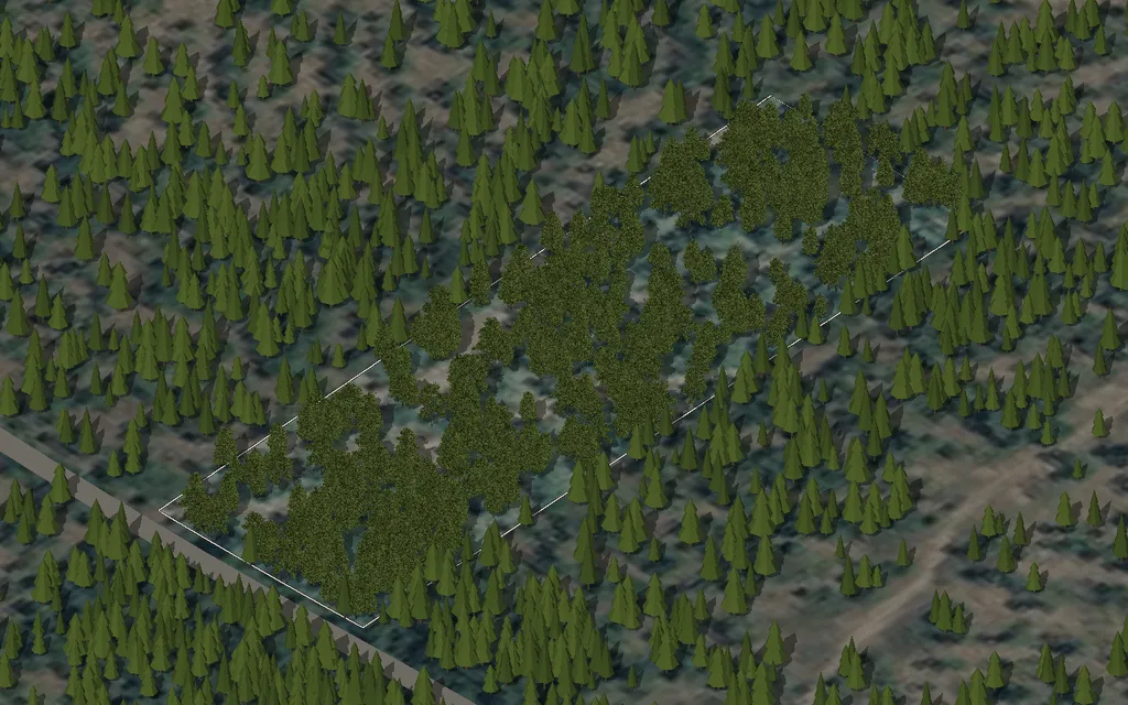
Parcel 40 on Mustang St, seen from the south-west over an aerial photograph, with the property line, the road and the nearby utilities drawn in and nothing built on it yet.

Try it on

See how it sits.

Drop a house on parcel 40 and move it around. The shapes are generic, but the property line, the pavement and the utility stubs are from the approved drawings, so the distances are real.

Aerial photograph: USGS, The National Map, public domain. Property line, road and utilities from the approved drawings. Nothing has been placed on it; that part is yours.

Roughly 6.13 acres of ponderosa and mixed conifer, fronting Mustang St, with room to build well inside the plat's setbacks. Three-phase power available from Northern Lights, multi-gigabit fiber service under the neighborhood's broadband agreement, community water from the neighborhood system to a service stub at the lot, and your own septic system on the parcel per the county's rural residential rules.

Building placement is yours to work out with your architect and the county. The plat leaves generous room from the road, honors the natural drainage, and preserves the tree canopy the plat map shows. Neighbouring parcels are similarly sized, which keeps the feel of the whole road corridor consistent.

Note from the plat

Acreage per approved construction plans, Sheet C-4 (Olson Engineering job 23081, approved by Lakes Highway District 02/03/2026).

Outline map of the Clagstone plat. Homesite 40 is filled in, with the other fifty-seven homesites and the four common tracts drawn as thin outlines around it, the interior streets and the North Clagstone Road frontage as lines, and the well, cluster mailboxes and bus stop marked.Cluster mailboxesSchool bus stopCommunity well
Parcel 40 · Mustang St · 6.13 acresThis homesiteWell, mail and bus stopOpen the full plat map

Come walk this parcel.

Boots on the ground beats any web page. We'll meet you at the entrance, plat in hand, and answer questions on the parcel itself.